Measurements.CreateRuler(RulerType, IList<CoordPoint>) Method
Creates a ruler of the specified type to measure distance or area between coordinate points passed as the second parameter.
Namespace: DevExpress.XtraMap
Assembly: DevExpress.XtraMap.v26.1.dll
Declaration
Parameters
| Name | Type | Description |
|---|---|---|
| rulerType | RulerType | The type of the created ruler. |
| points | IList<CoordPoint> | Coordinate points between which the ruler measures the distance or area. |
Returns
| Type | Description |
|---|---|
| MapRuler | The created ruler. |
Remarks
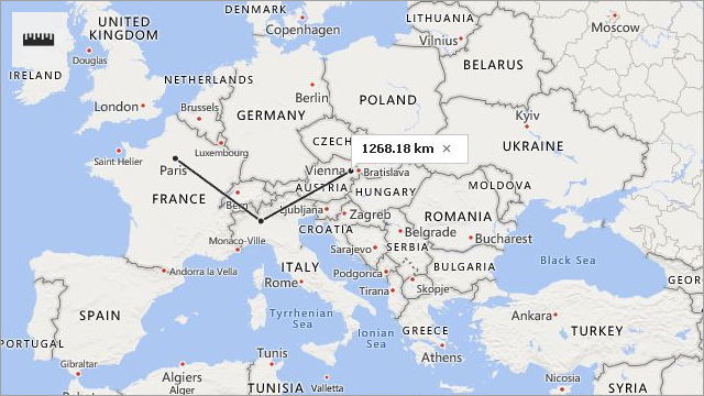
The following code adds a distance ruler to the map:
MapRuler ruler = mapControl1.Measurements.CreateRuler( RulerType.Distance,
                                                        new List<CoordPoint>() {
                                                            new GeoPoint(48.864716, 2.349014),
                                                            new GeoPoint(45.46427, 9.18951),
                                                            new GeoPoint(48.20849, 16.37208) });
See Also