MapPolyline Class
The class used to draw a polyline on a map.
Namespace: DevExpress.XtraMap
Assembly: DevExpress.XtraMap.v19.1.dll
Declaration
public class MapPolyline :
    MapShape,
    IPointContainerCore,
    ISupportCoordPoints,
    ISupportIntermediatePoints,
    IEditableItem,
ISimplifiableItemRelated API Members
The following members return MapPolyline objects:
Remarks
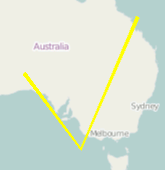
The following image shows an example of a map polyline object.
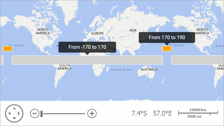
Note that, a map shape should fulfill the following condition to cross the 180th meridian: one or several points’ longitudes should exceed the 180 (-180) limit:
MapPolygon polygon = new MapPolygon();
polygon.Points.Add(new GeoPoint(10, -170));
polygon.Points.Add(new GeoPoint(10, 170));
polygon.Points.Add(new GeoPoint(-10, 170));
polygon.Points.Add(new GeoPoint(-10, -170));
vectorItemStorage.Items.Add(polygon);

// Point longitudes enclose the 180 meridian.
MapPolygon polygonCross180 = New MapPolygon();
polygonCross180.Fill = Color.Orange;
polygonCross180.Points.Add(new GeoPoint(30, 190));
polygonCross180.Points.Add(new GeoPoint(30, 170));
polygonCross180.Points.Add(new GeoPoint(20, 170));
polygonCross180.Points.Add(new GeoPoint(20, 190));
vectorItemStorage.Items.Add(polygon180);
The code above produces the following image:
Example
Note
A complete sample project is available at https://github.com/DevExpress-Examples/how-to-create-different-map-shapes-t139819
var polyline = new MapPolyline() { StrokeWidth = 4, Stroke = Color.Yellow };
polyline.Points.AddRange(new GeoPoint[] {
    new GeoPoint(-29,130),
    new GeoPoint(-40,140),
    new GeoPoint(-20,150)
});
ItemStorage.Items.Add(polyline);
See Also