Web Map Service Provider
- 2 minutes to read
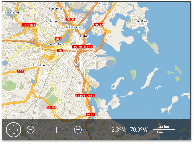
Web Map Services (WMS) provide the capability of receiving geographical data images from a map server.
The Map Control allows you to use Web Map Services as data providers for an ImageLayer of the MapControl.
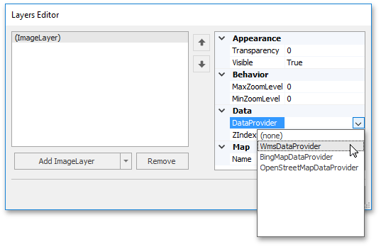
To work with the provider, use the WmsDataProvider class.
The WmsDataProvider class allows you to use the Web Map Services to provide data to a Map control. To do this, assign an instance of the WmsDataProvider class to the ImageLayer.DataProvider property.
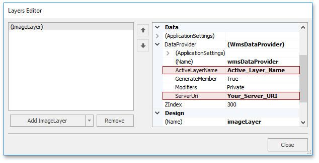
To connect to the required web server, define the server URI path using the WmsDataProvider.ServerUri property.
If the required layer name, which is provided by the map server, is known, then assign it to the WmsDataProvider.ActiveLayerName property.
In other cases, if layer names are unknown, it is possible to handle the WmsDataProvider.ResponseCapabilities event. CapabilitiesResponsedEventArgs provides the CapabilitiesResponsedEventArgs.Layers collection, containing available layers, and other layer parameters, such as WmsLayer.Name, WmsLayer.Children and WmsLayer.Title. Refer to the How to: Obtain Data from a Web Map Service example to learn how to obtain layer information in the event handler.
To learn how to receive a collection of available layers, see the How to: Obtain a Collection of Available Layers in the ResponseCapabilities Event Handler example.