SqlGeometryDataAdapter Class
A data adapter that loads data from a SQL geometry data source and displays it on vector layers.
Namespace: DevExpress.XtraMap
Assembly: DevExpress.XtraMap.v23.2.dll
NuGet Package: DevExpress.Win.Map
Declaration
Remarks
The SQL geometry data type represents data in a Euclidean (flat) coordinate system. For more information about the SQL geometry type, refer to the following Microsoft topic: Spatial Data.
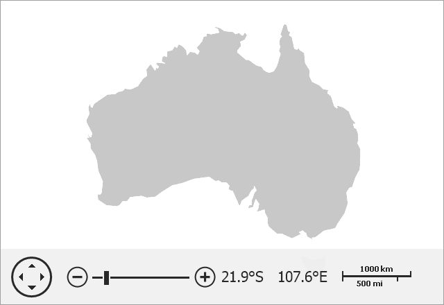
The image below shows a vector map loaded from a SQL geometry data source.
The following table lists supported SQL geometry elements and related map items:
Sql Geometry Element | Map Item |
|---|---|
Point | |
LineString | |
Polygon | |
MultiPoint | |
MultiLineString | |
MultiPolygon | |
GeometryCollection that contains elements listed above. | Related map items. |
Load Data
Note
Reference Microsoft.SqlServer.Types to work with the SQL Server geometry data type in your .NET project.
To load data from a SQL geometry data source, follow the steps below:
- Create a
SqlGeometryDataAdapterobject. - Specify its SqlGeometryDataAdapter.ConnectionString, SqlGeometryDataAdapter.SqlText and SqlGeometryDataAdapter.SpatialDataMember properties.
- Assign this object to the VectorItemsLayer.Data property.
Note that all field values loaded from the database (except for the SpatialDataMember field) are stored as attributes for each generated SqlGeometryItem object.
In this example, you can use the Map Editor to edit shapes. To save changes, call corresponding SQL commands in the MapEditor.MapItemEdited event handler.
using DevExpress.XtraMap;
using System;
using System.Data.SqlClient;
using System.IO;
using System.Windows.Forms;

namespace SqlGeometry {
    public partial class Form1 : Form {
        const string filePath = "..\\..\\Data\\SQLG.mdf";
        static string fullFilePath = Path.GetFullPath(Path.Combine(Application.StartupPath, filePath));
        string connectionString = @"Data Source=(LocalDB)\MSSQLLocalDB;AttachDbFileName=" + fullFilePath + ";Database=SqlGeometryDB;Integrated Security=True;MultipleActiveResultSets=True";
        private void Form1_Load(object sender, System.EventArgs e) {
            SqlGeometryDataAdapter adapter = new SqlGeometryDataAdapter() {
                ConnectionString = connectionString,
                SqlText = "SELECT TOP 1000 [id], [GeomCol1],[TextCol] FROM [dbo].[DemoTable]",
                SpatialDataMember = "GeomCol1"
            };
            VectorItemsLayer layer = new VectorItemsLayer() {
                Data = adapter,
                ShapeTitlesPattern = "{TextCol}"
            };
            layer.DataLoaded += layer_DataLoaded;
            mapControl1.Layers.Add(layer);
            mapControl1.MapEditor.ShowEditorPanel = true;
            mapControl1.MapEditor.MapItemEdited += MapEditor_MapItemEdited;
        }

        void layer_DataLoaded(object sender, DataLoadedEventArgs e) {
            mapControl1.ZoomToFitLayerItems();
        }

        private void MapEditor_MapItemEdited(object sender, MapItemEditedEventArgs e) {
            foreach (MapPath path in e.Items) {
                int id = Convert.ToInt32(path.Attributes["id"].Value);
                string modified = path.ExportToWkt().ToString();
                path.Attributes["TextCol"].Value = "Australia" + " " + DateTime.Now.Second.ToString();

                using (SqlConnection cn = new SqlConnection() { ConnectionString = connectionString }) {
                    cn.Open();
                    // For more information about SRID parameters, see https://docs.microsoft.com/en-us/sql/t-sql/spatial-geography/stsrid-geography-data-type?view=sql-server-ver15
                    SqlCommand updatecmd = new SqlCommand("UPDATE DemoTable SET GeomCol1 = geometry::STGeomFromText('" + modified + "', 4326 ) WHERE id = " + id.ToString(), cn);
                    updatecmd.ExecuteNonQuery();

                    SqlCommand updateattr = new SqlCommand("UPDATE DemoTable SET TextCol = '" + path.Attributes["TextCol"].Value.ToString() + "' WHERE id =" + id.ToString(), cn);
                    updateattr.ExecuteNonQuery();
                }
            }
        }
    }
}
Change Map Appearance
You can change shape colors based on shape data. Refer to the following help topic for more information: Colorizers.
You can also group items of the same type. To do this, initialize the MapDataAdapterBase.Clusterer property with a clusterer that aggregates map items based on their location.
Use the MapControl.ZoomToFitLayerItems method to zoom the map to fit layer items.
private void Form1_Load(object sender, EventArgs e) {
  SqlGeometryDataAdapter adapter = new SqlGeometryDataAdapter() {
    ConnectionString = connectionString,
    SqlText = "SELECT TOP 1000 [id], [GeomCol1],[TextCol] FROM [dbo].[DemoTable]",
    SpatialDataMember = "GeomCol1"
  };
  VectorItemsLayer layer = new VectorItemsLayer() {
    Data = adapter,
  };
  layer.DataLoaded += Layer_DataLoaded;
}

private void Layer_DataLoaded(object sender, DataLoadedEventArgs e) {
  mapControl1.ZoomToFitLayerItems();
}