Providing Data
- 2 minutes to read
The Dashboard Designer allows you to bind dashboard items to data in a uniform and similar manner. See the Bind Dashboard Items to Data topic for common information.
The difference is in the data sections that the specific dashboard item has. This topic describes how to bind the Geo Point Map dashboard item to data in the Designer or in code.
Binding to Data in the Designer
The image below shows a sample Geo Point Map dashboard item that is bound to data.
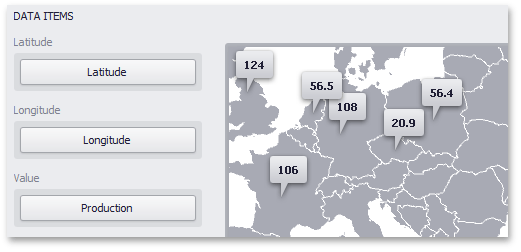
Note that the Geo Point Map provides two data item groups for data binding: DATA ITEMS and TOOLTIP DATA ITEMS. Tables below list the available data sections.
Data Items
| Section | Processed as | Description | API |
|---|---|---|---|
| Latitude | Dimension | Accepts a dimension used to provide geographic latitude. | GeoPointMapDashboardItemBase.Latitude |
| Longitude | Dimension | Accepts a dimension used to provide geographic longitude. | GeoPointMapDashboardItemBase.Longitude |
| Value | Measure | Accepts values related to geographic points. These values are displayed within map callouts. | GeoPointMapDashboardItem.Value |
Tooltip Data Items
| Section | Processed as | Description | API |
|---|---|---|---|
| Dimensions | Dimension | Accepts dimensions allowing you to add supplementary content to the tooltips. | GeoPointMapDashboardItemBase.TooltipDimensions |
| Measures | Measure | Accepts measures allowing you to add summaries to the tooltips. | MapDashboardItem.TooltipMeasures |
Example
The following example demonstrates how to bind a Geo Point Map dashboard item to data in code.
using System.Windows.Forms;
using DevExpress.DashboardCommon;
using DevExpress.DataAccess.ConnectionParameters;
using DevExpress.DataAccess.Sql;

namespace Dashboard_CreateGeoPointMap {
    public partial class Form1 : Form {
        public Form1() {
            InitializeComponent();

            Dashboard dashboard = new Dashboard();
            DashboardSqlDataSource dataSource = new DashboardSqlDataSource();
            CustomSqlQuery sqlQuery = new CustomSqlQuery("Cities", "select * from Cities");
            dataSource.ConnectionParameters =
                new Access97ConnectionParameters(@"..\..\Data\Cities.mdb", "", "");
            dataSource.Queries.Add(sqlQuery);

            GeoPointMapDashboardItem geopointMap = new GeoPointMapDashboardItem();
            geopointMap.DataSource = dataSource;
            geopointMap.DataMember = "Cities";

            geopointMap.Area = ShapefileArea.WorldCountries;

            geopointMap.Latitude = new Dimension("Latitude");
            geopointMap.Longitude = new Dimension("Longitude");
            geopointMap.Value = new Measure("Population");

            dashboard.Items.Add(geopointMap);
            dashboardViewer1.Dashboard = dashboard;
        }
    }
}